Did you have a nice summer?
Yup, it's over — at least for all of us whose kids return to Alameda Unified schools today — and yup, it was hardly "summer," given this year's unusually cool temperatures.
My kids tried a variety of activities this summer — and as a side effect, I got to experience dropping them off in a variety of locations around Alameda.
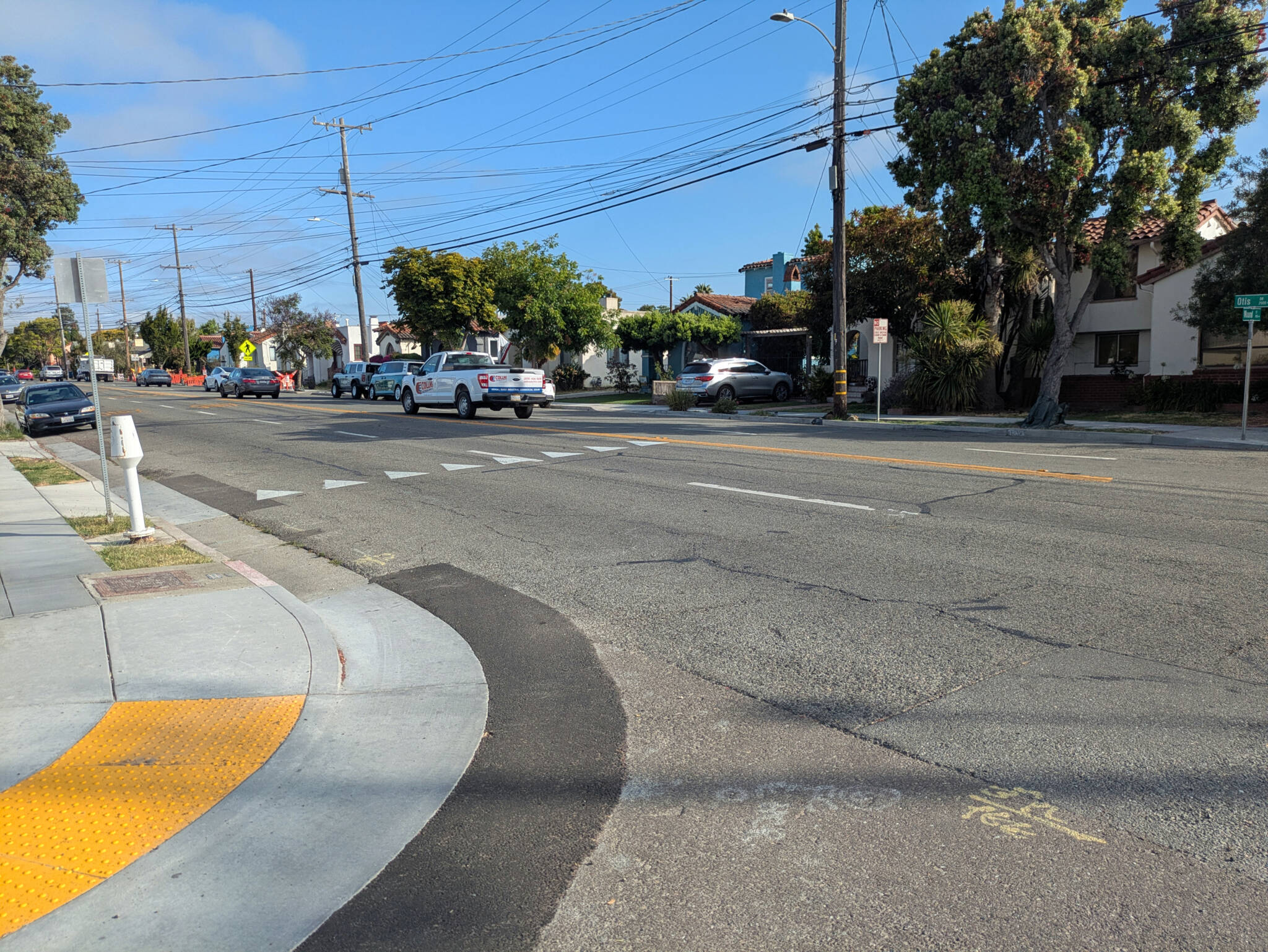
Otis Drive
Our son's kindergarten teacher ran a summer camp out of her house and he went there for all eight weeks. Each day included walking field trips to the beach, or the bird sanctuary, or Krusi Park, or Lincoln Park — as well as lunches and an agua fresca of the day. (Doesn't that sound great?)
Turns out his teacher lives directly on the state-owned portion of Otis Drive. When I began my own advocacy efforts, I knew about the issues in abstract — getting to know some of the people who live directly on this "highway" has put faces to the problem.
This blog's last post on progress on Otis Drive in June was reflective, almost patient. But it turns out that actually walking across and along Otis Drive to take our five-year old to summer camp most mornings, as well as seeing the other parents walking or bicycling their own kids to the camp, instantly reminded me: This street sucks.
Yes, Caltrans District 4 has committed to studying a road diet, with paperwork estimated for 2028 and construction completion estimated by 2032... but in the meantime, the people who live here will continue to have to bear the effects of a roadway that encourages speeding and provides little protection to pedestrians and cyclists needing to cross.
Harbor Bay Club
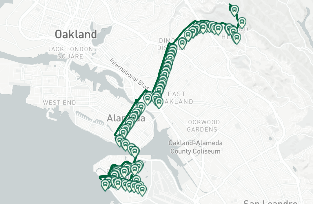
Our daughter tried a wide range of camps around the East Bay. Her first week was at Harbor Bay Club. After dropping her brother off on Otis Drive, she and I took the scenic route of cycling over the Bay Farm Bike/Ped Bride, over the "Wooden Bridge" (more on this in a moment), and along Bay Farm's bay-front trail (also more on that as well):
I'm not a particularly fast cyclist, but I still think our time by bike was approximately the same as if we had driven there (which would have required a more circuitous route and waiting at more traffic lights).
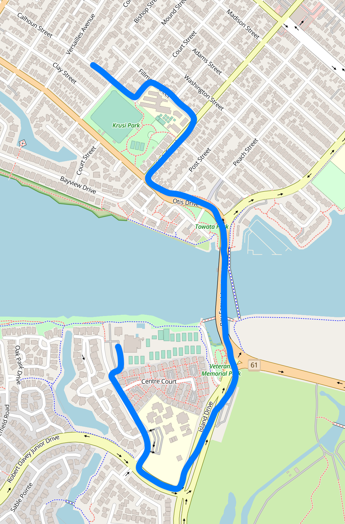
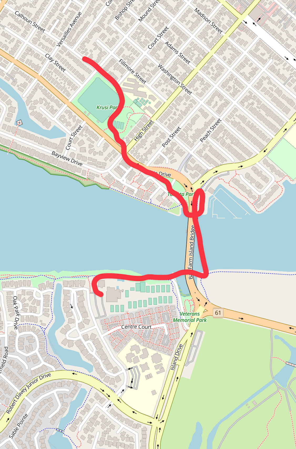
Left: Driving is longer, with more lights to wait at; Right: Cycling is shorter (C) OpenStreetMap contributors
The Wooden Bridge — which cyclists and pedestrians use to connect underneath the Bay Farm auto bridge — is quite the buuuuumpyyyyyyy ride. The City recently shared that:
This week the East Bay Regional Parks District (EBRPD) is placing new signs instructing bicyclists to dismount and walk their bikes while crossing the Wooden Bridge that connects the Bay Farm Bicycle Bridge to the Bay Trail. This precaution is due to uneven decking on the bridge. EBRPD, which maintains this bridge, recently made some minor improvements to the decking. They have determined that the bridge is nearing the end of its useful life, with the timeline accelerating due to higher King Tides in recent years.
The City is coordinating with EBRPD to make the best use of the existing bridge while the City studies future access alignments. In the meantime, the City joins EBRPD in urging riders to walk bikes and take precautions when traveling on the bridge. For questions about bridge maintenance, reach out to EBRPD.
All of the public entities involved seem to agree that the Wooden Bridge — which was constructed in 1984 —needs to be replaced soon, but unfortunately EBRPD is not yet stepping up to make it happen.
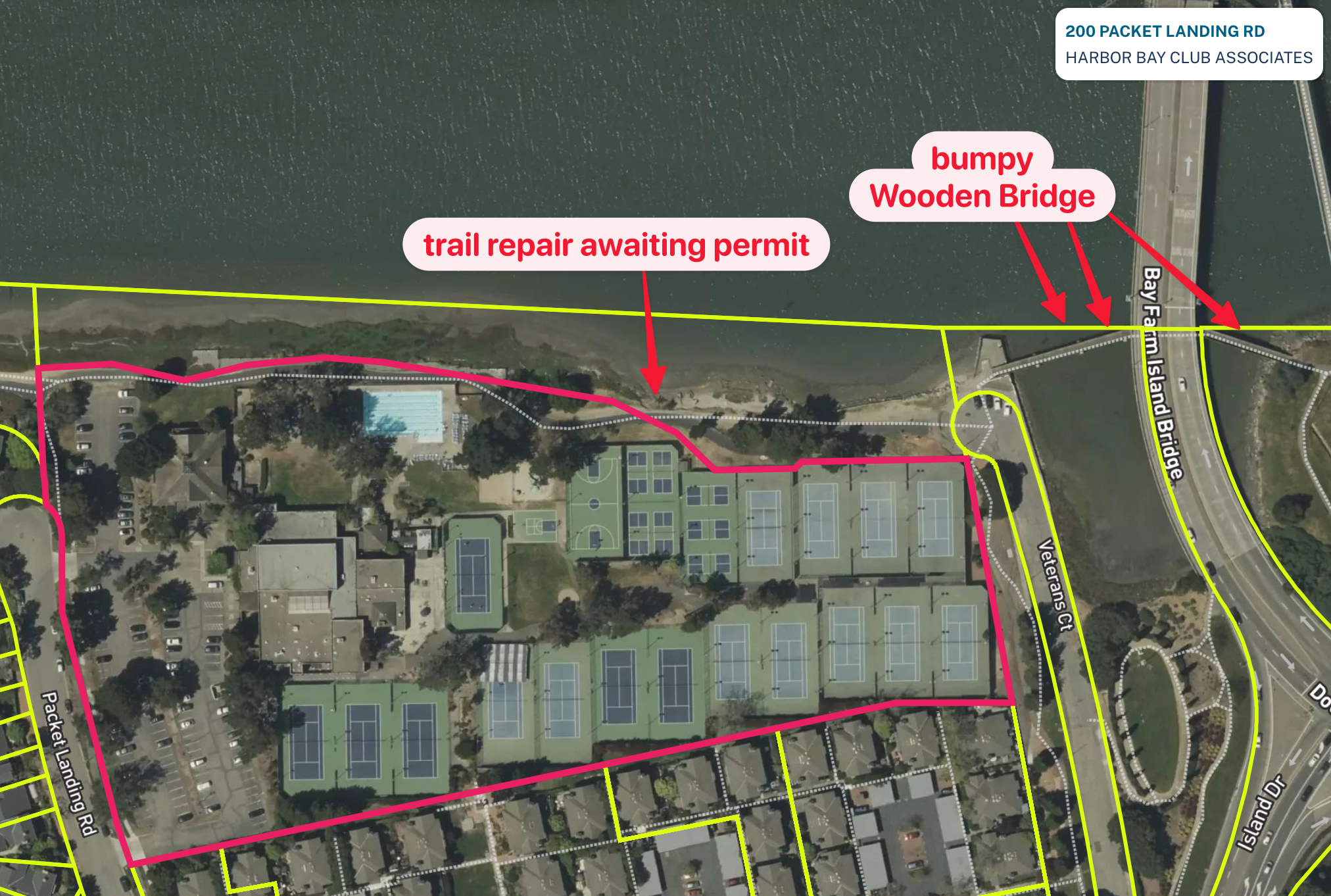
As you walk or cycle along the backside of the Harbor Bay Club, you can also see that that shoreline is in need of repairs. According to APRD:
We are aware of the eroded areas along the north shore of Bay Farm Island adjacent to the San Leandro Channel. For the immediate future, the Public Works Department is pursuing an amendment to the Original BCDC permit that installed the path. This permit amendment is anticipated to allow installation of temporary measures (gabion rock walls) to protect these areas against further damage while a permanent, nature-based solution is pursued [with funding from a larger federal grant program that the Trump/Musk administration has illegally halted].
The city has been waiting upwards of a year for approvals from BCDC and the SF Bay Regional Water Board just for these immediate repairs. But apparently putting even the smallest amount of rock in the bay requires a lengthy review.
While cycling along the backside of the Harbor Bay Club, I alternated between wondering if the club's hot tub is nice — and wondering what portion of the privately owned parcel Councilmember Tony Daysog thinks should be surrendered to the bay. Should the "incoming tides" overtake the tennis courts? Or the swimming pool? Or the parking lot?
More seriously, if the Wooden Bridge or this section of public trail goes out, it's not just a nice-to-have amenity that will disappear. This is the way that many students travel from their homes in Bay Farm to Lincoln Middle School over on Alameda Island.
(My understanding is that approximately one in four Lincoln students arrive each morning by bike.)
Please get moving, BCDC/SFRWQCB/EBMUD!
Alameda Island's central gridiron
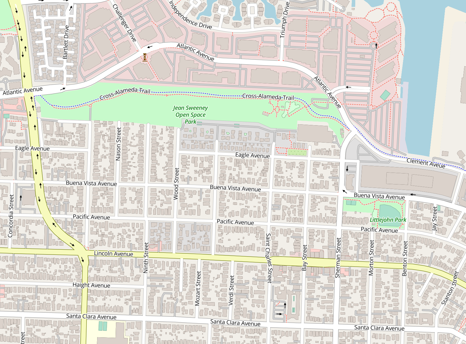
Perhaps the hottest ticket in terms of summer camps in town is STEAM camp with Otis Elementary's STEAM teacher. She lives on the street grid south of Jean Sweeney Open Space Park, which also served as a mid-day walking field trip for the campers.
Getting there by bike highlighted for me some of the challenges of this part of town:
- east-west movement is comparatively straightforward
- but the places to move easily transition north-south, whether on foot or by bike, are few
Cross traffic on Buena Vista Ave and on Lincoln Ave is fast and hardly polite. We had to be strategic in where and how to get across.
I'm not aware of any planned improvements for Buena Vista, but Lincoln will — fingers crossed — be upgraded in phases. (The federal government had pledged $16mm toward the project, but with the Trump/Musk administration being so undependable, the City of Alameda is reducing risks by contracting out the project in tranches.)
North-south movement will also be improved when trail connectors are added to Jean Sweeney Open Space Park, adding entry points on both the southern neighborhood side (where my daughter and fellow campers would enter from on their STEAM camp field trips) as well as on the northern office park side.
While the state's water control entities have slowed down basic repairs to trails near Harbor Bay Club, it's the state Department of Toxic Substances Control that's slowed down construction of similarly basic concrete paths being added to Jean Sweeney. As the site of a former railroad, there's apparently enough pollution in the area to warrant review.
(A similar DTSC review slightly delayed construction of the Tilden/Broadway roundabout — that being the eastern end of the same Alameda Belt Line, so presumably some of the same junk in the ground.)
Transit to trails
For another two weeks, my daughter tried ARPD's Trailblazers camp. Each morning, we walked her to Otis Elementary. Then the campers and staff all took a bus up to the Oakland Hills for a day's work of hiking and outdoor activities. They also enjoyed staying up there for a two-night camping trip.
While their bus was chartered by ARPD just for the campers, you can now easily take your own bus ride from the flat lands of Alameda up to the redwoods of the Oakland Hills. As of August 10, AC Transit's Line 31 now runs from Bay Farm to Alameda Island up Fruitvale Ave and finally ends at Chabot Space & Science Center in Joaquin Miller Regional Park.
Alameda Point's Enterprise District
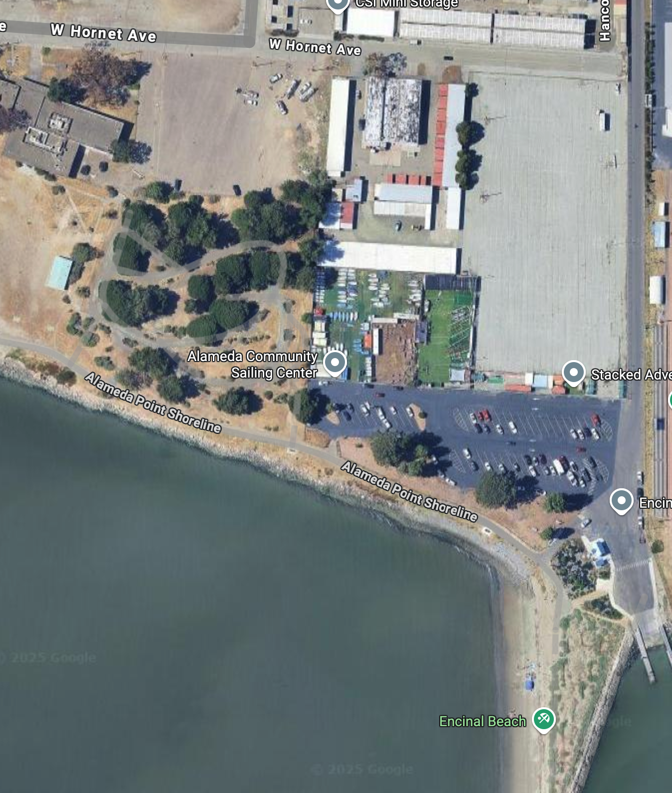
For the final two weeks of the summer, my daughter enjoyed learning to sail at Alameda Community Sailing Center, which is located at the southern edge of Alameda Point.
To access this site required navigating the construction of Central Ave. We did that one morning on my bike, after which my daughter said we should take a much more out of the way route, which added 10 minutes, just so we could avoid the noisy, bumpy, and somewhat menacing construction.
The Central Ave Safety Project is going to be great once it's finally finished, but in the meantime, the construction is a challenge for everyone using every mode of transport.
One more observation: Campers had to each bring two water bottles each day. There's no potable water on site. Developers looking to realize dreams in this so-called Enterprise Zone — for example, that firm talking about building a surfing park — sure have their work cut out for them!
See your around town
Now that school's back in session, remember to... get your weekday lunches on Park Street before 12:35 p.m.... or go to one of the places like Scolari's that's too expensive for the Alameda High students to mob... and also drive carefully.
See you all around town!