Redesigning the entry from the Fruitvale Bridge to Alameda
At tonight's Alameda (city) Transportation Commission, the city's planners and consultants will be presenting and discussing plans to redesign one of the key entries from the "the mainland" to Alameda Island:
Public engagement
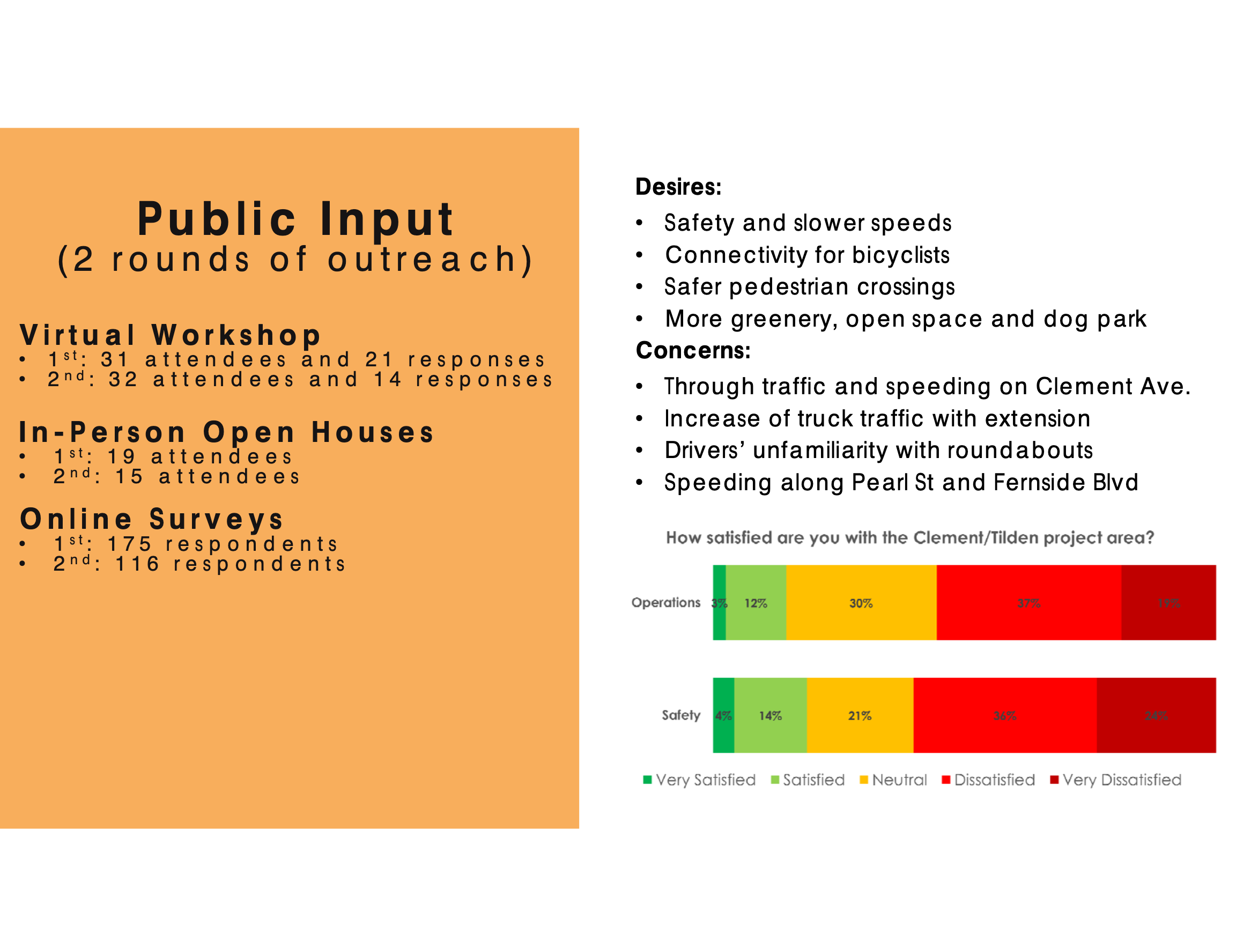
Staff have conducted a good deal of public outreach that has informed the preliminary designs being presented today. Outreach has involved both synchronous remote, synchronous in-person, and asynchronous means:
Comments on the draft concept
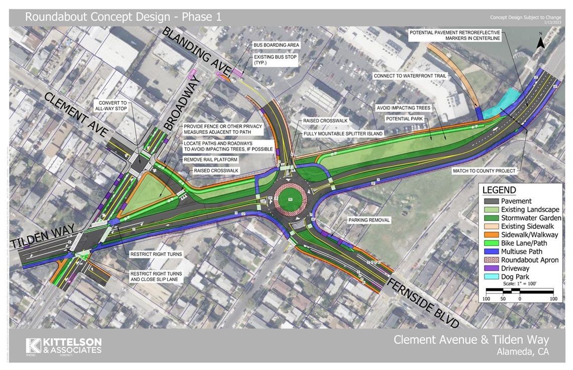
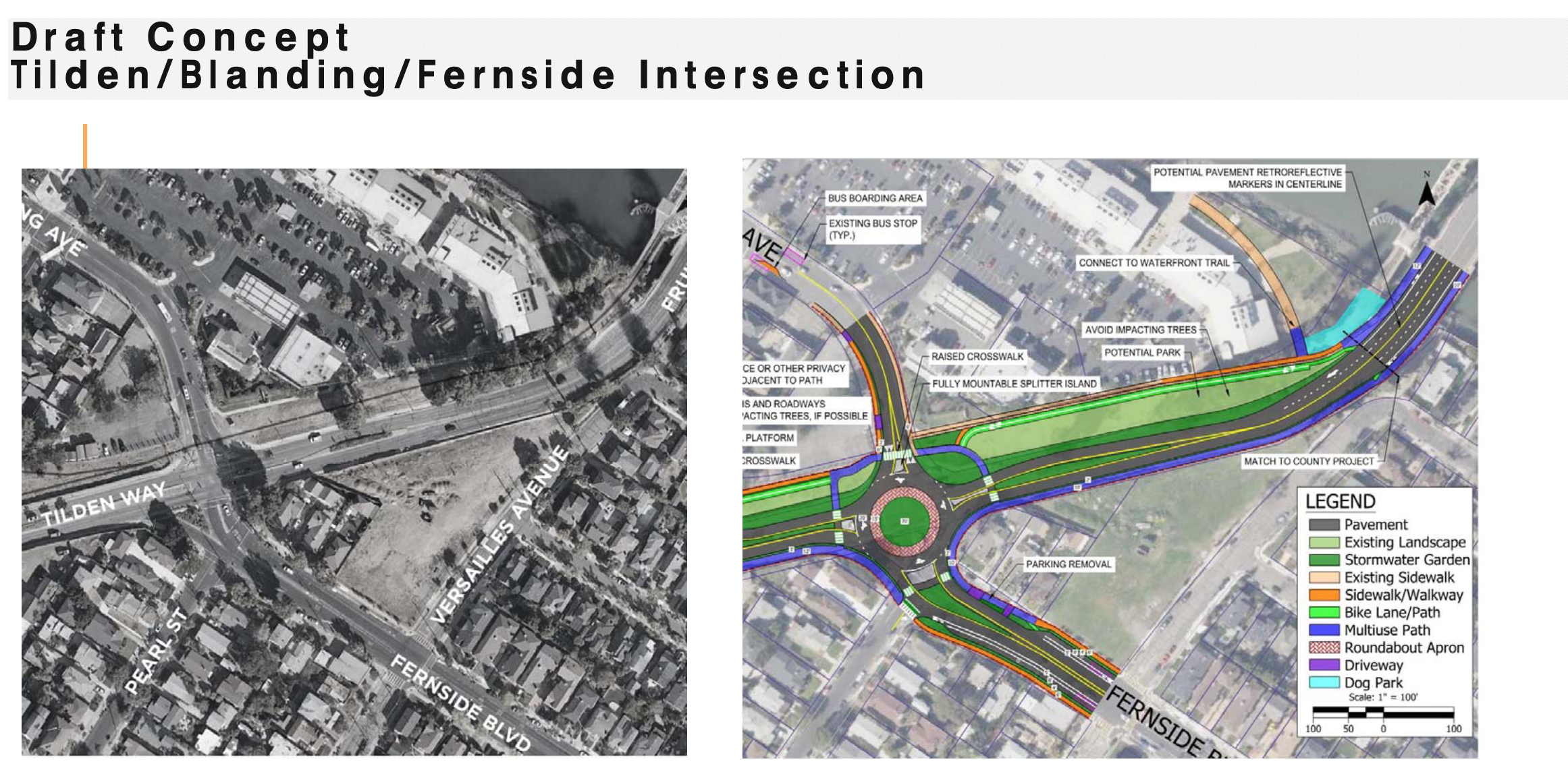
The draft concept is described in depth in the staff report.
The board of Bike Walk Alameda already has submitted useful comments in support of the overall project approach and some useful additional suggestions to the Transportation Commission.
Also in the correspondence packets (packet one and packet one) are my own more miscellaneous thoughts. For those who are interested in nitpicking details, read on!
Roundabout: Overall, a modern roundabout looks like a very useful improvement over the existing Tilden/Fernside/Blanding intersection for all users. For pedestrians, it will be great to be able to cross over any direction/leg (that's not possible currently). And for motorists it looks like an equivalent or better experience, compared to the small intersection where drivers have to wait through many traffic light cycles. For cyclists, I am not fully able to understand how the flow would work — perhaps staff and consultants can describe that in more detail at the TC meeting.
Pearl: Am I right in understanding that this design would prevent a driver who's going northbound on Pearl to directly reach Oakland-bound Tilden? If so, I think that is a good change. Google Maps and nav apps often direct northbound drivers to take Pearl instead of Broadway. Many of these drivers turn right from Otis Drive onto Pearl and continue all the way northbound to Fernside and Tilden. Pearl isn't configured for thru traffic, so drivers have to stop at multiple stop signs and have to cross a few arterials without the benefit of cross traffic stopping — from what I see, the drivers cutting north on Pearl disregard those limitations and just roll through stop signs and cross aggressively against oncoming traffic at Pearl/Encinal, Pearl/Central, and finally when going from Pearl across the weird little Pearl/Fernside/Tilden intersection. Forcing northbound traffic to go right on Fernside looks like a good way to slightly disincentive this type of thru traffic without fully interrupting the grid.
Project boundary at Fruitvale Bridge: How will cyclists transition between bike lanes on the Fruitvale/Oakland side and the CAT on the Alameda side? It would be unfortunate if this were a dangling edge in the manner that Clement/Willow was left unfinished and currently forces eastbound cyclists to suddenly cut across oncoming traffic. Please consider ways to support and guide cyclists to make this transition in both directions between Tilden and Fruitvale, rather than deferring this question to the future.
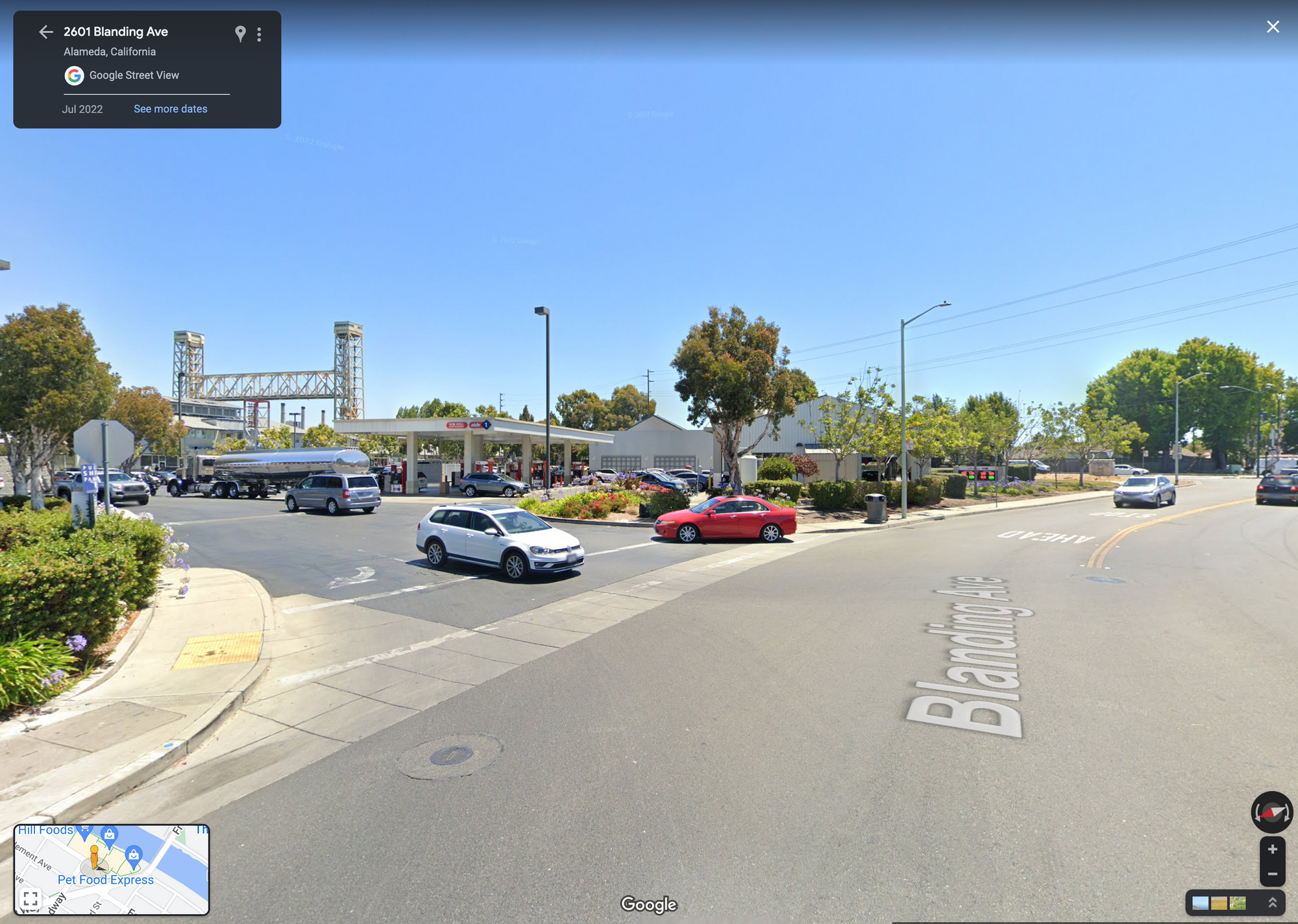
Project boundary at Blanding Ave: The curb cut entrance into Bridgeside Shopping Center is an existing challenge for pedestrians and cyclists. It's very wide — exposing peds and cyclists to cross-cutting auto traffic for longer than is comfortable. And it has curved edges that encourage drivers to take it at a faster speed than necessary. When there are cars trying to turn in multiple directions at once, it can also just be a frustrating experience for drivers. Please consider including this in the project boundaries and reducing the width and angle of this curb cut.
Project boundary at Fernside: How will cyclists be able to travel to and from the slow street/neighborhood greenway on Versailles?
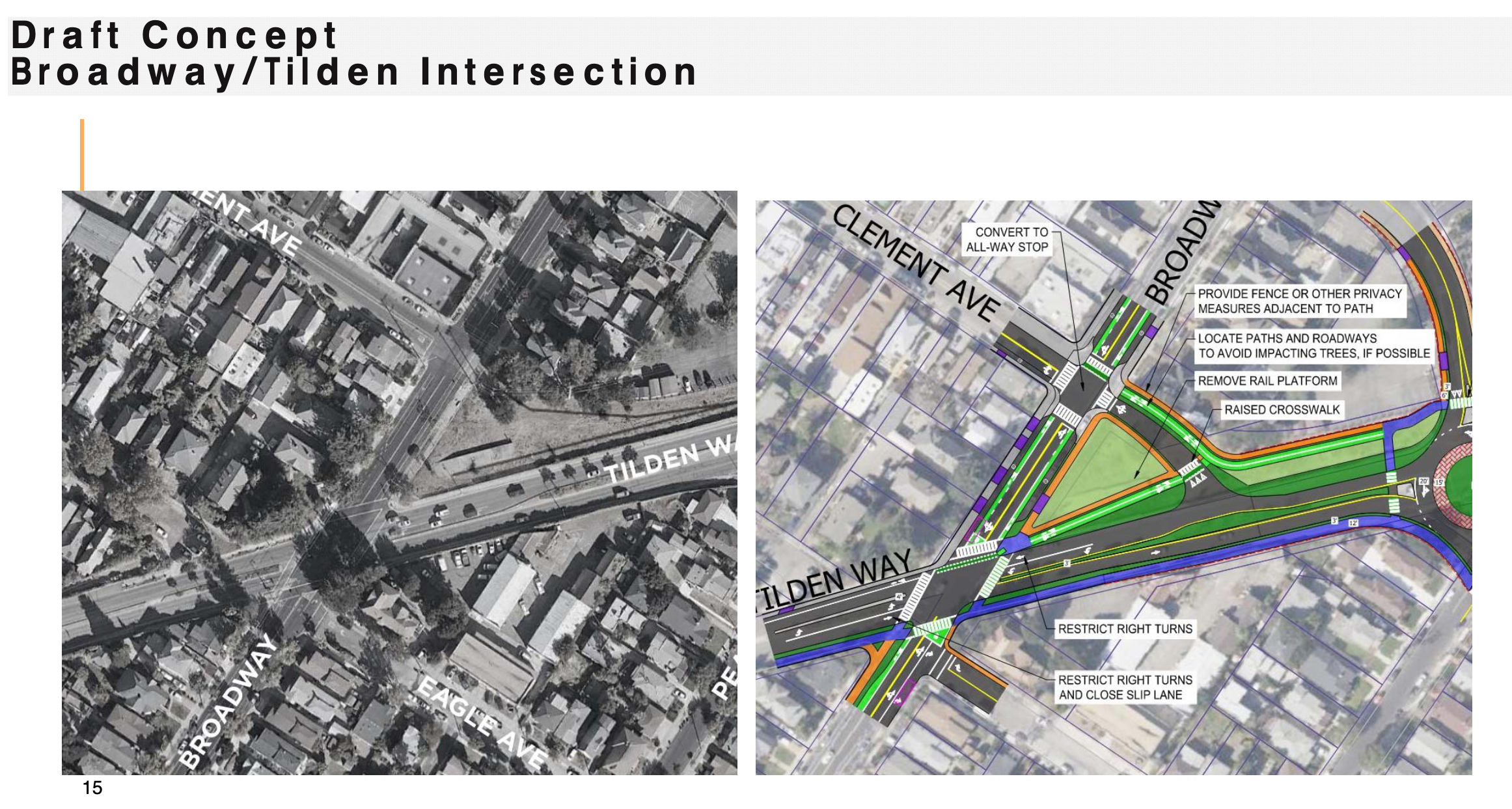
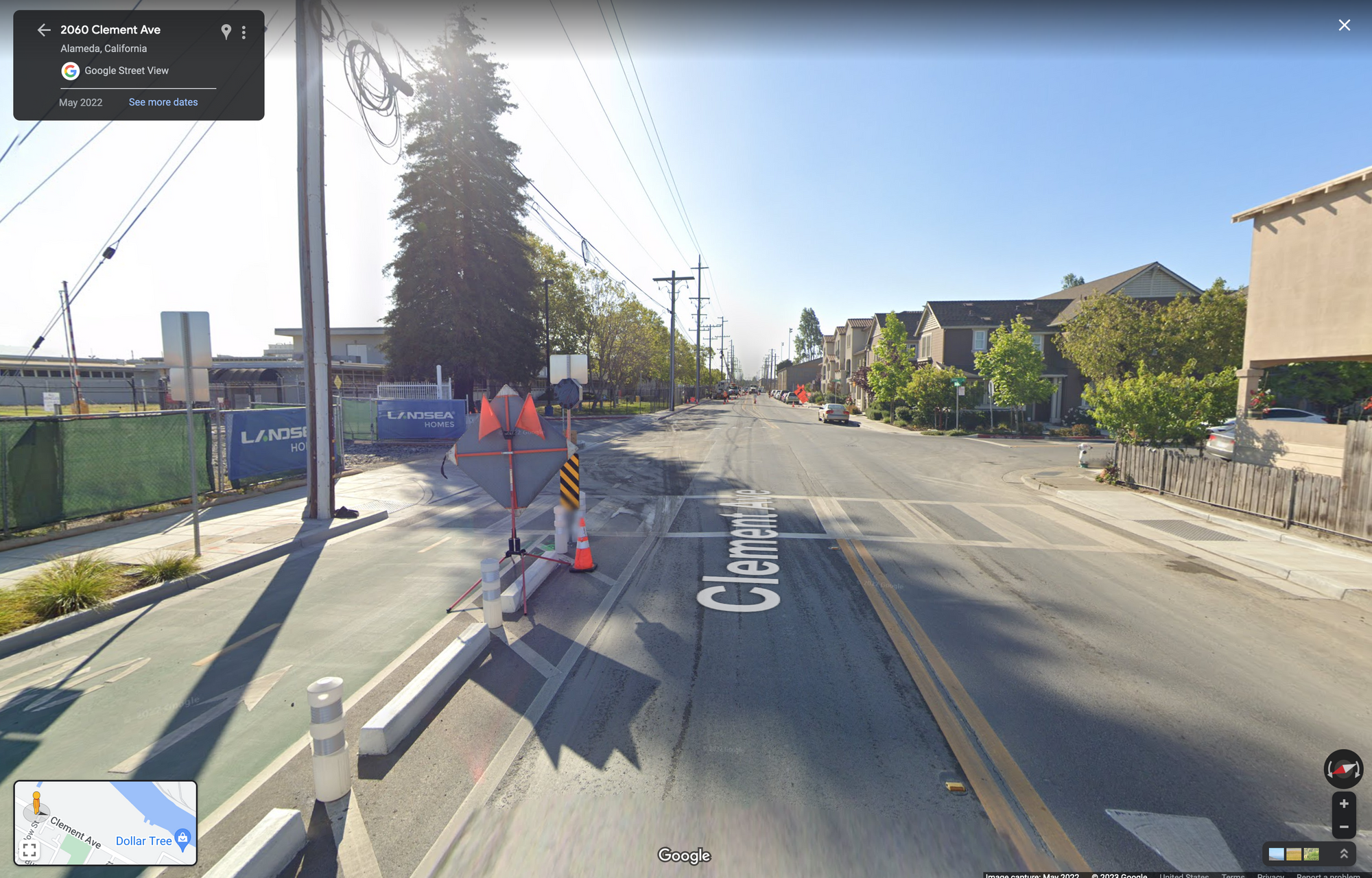
Clement: I was initially disappointed to see new pavement added for auto traffic on Clement. However, the more time I spent thinking and talking with others about these plans, I can understand more of the benefits. The areas around the Webster/Posey tubes suffer from directing too many vehicles through too few aerterials and intersections — having more options and a more interconnected street network around Clement/Tilden will be helpful for all users. It's important to see the four way stop at Clement/Broadway. Please do consider more treatments such as raised crosswalks and raising the CAT at Clement/Broadway. My initial reaction was to think that space was best kept for people, rather than traffic — but I can see how this is a useful "relief valve," especially if the edges of the CAT and ped crosswalks are nicely and carefully designed.
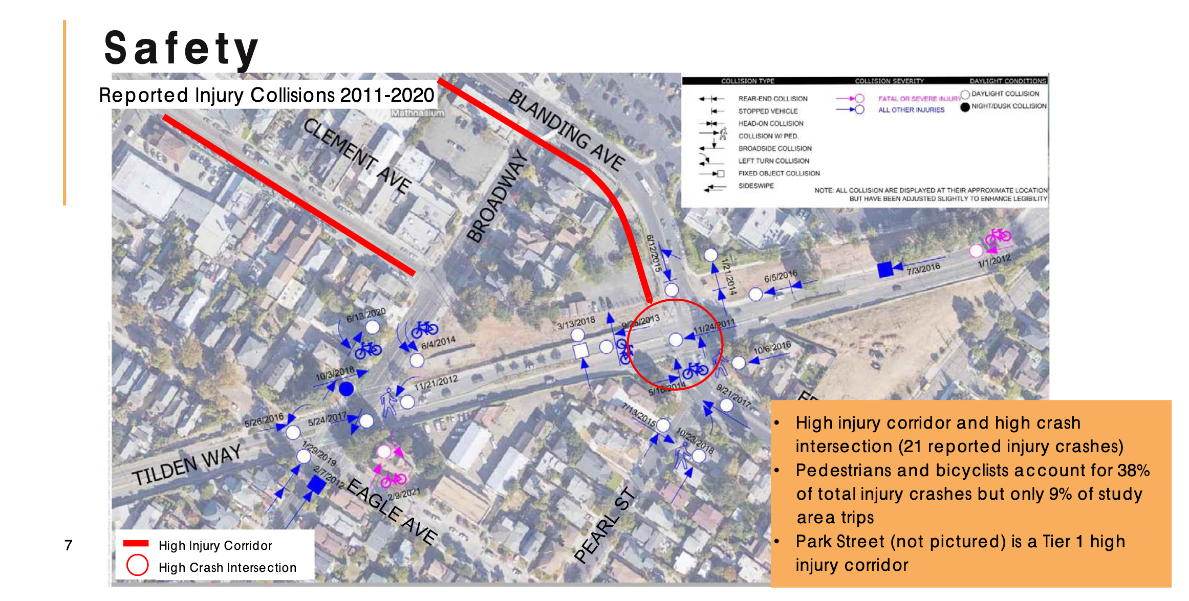
Broadway/Tilden: My understanding is that this is the intersection where Cleofas Guzman was killed by a driver while cycling in 2021, and this is the first time since that fatal crash that this intersection is being considered as part of a City of Alameda project. Do any of these proposed changes reduce the odds of a similar crash occurring in the future or reduce the potential severity of a similar crash?