Last week, with the end of the school year approaching, my kindergartner came home from school with a gift bag. He, along with his classmates, had worked with their teacher to create their own time capsules, to each open upon their graduation from high school.
Last week, Alameda city staff, the city's elected leaders, readers of this blog, and yours truly were also engaged in an effort that will hopefully come to full fruition in the 2030s — as well as yielding some incremental progress in the next two years.
(Re)committing to targeted improvements
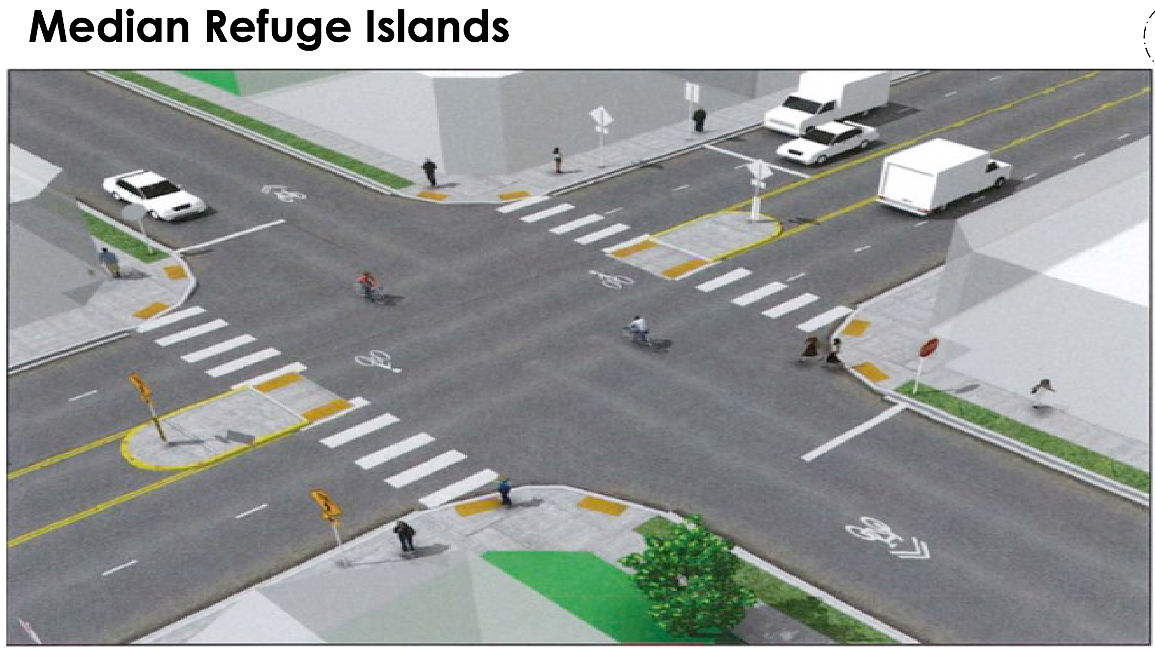
Thanks to a successful meeting-before-the-meeting, Caltrans staff have (re)committed to building pedestrian refuge islands — these features will make it slightly easier and safer for pedestrians to cross at Otis/Mound and Otis/Versailles.
Caltrans staff also discussed at last week's Transportation Commission meeting extending curbs at Otis/Bayview/High. This change will slow drivers and increase the waiting area for pedestrians and cyclists at this often-crowded corner. (However, the curb extensions will be built out of "quick build" materials — meaning pieces of plastic installed in the asphalt roadway itself, rather than extending the existing concrete at the level of the sidewalk.)
However, the intersection at Doolittle/Island and the connections between the off-street Bay Trail and the on-street lanes around Doolittle/Swan appear to still be underbaked in plans. Hopefully Caltrans staff are continuing to refine these details... although given their timeline to open this contract to bids in the middle of June, they better be working both quickly and carefully.
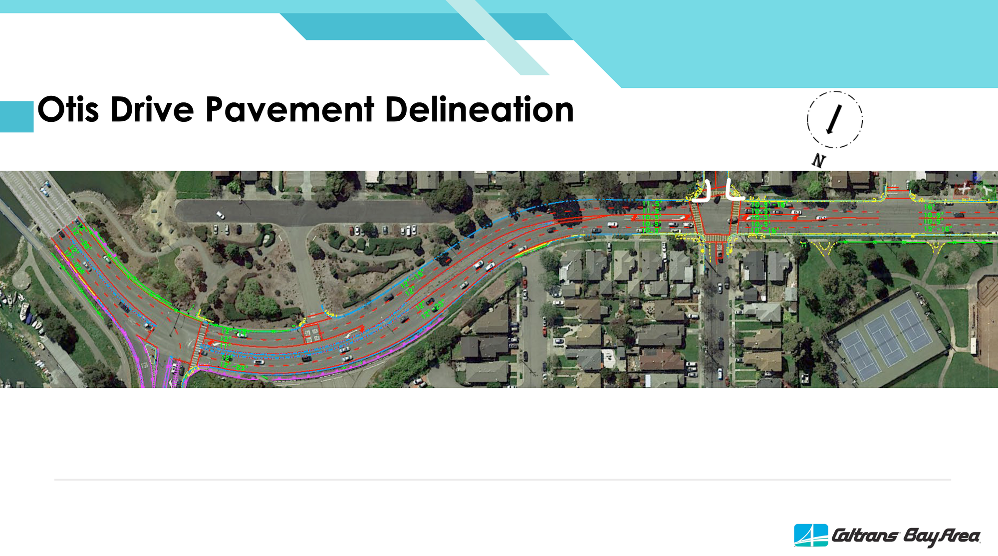
The above improvements are scheduled to start construction in January 2026 and to be completed by April 2027.
Shaping the next project for Otis Drive
Caltrans staff will also request funding from the California Transportation Commission to study and plan a more thorough set of safety improvements specifically for Otis Drive in Alameda:
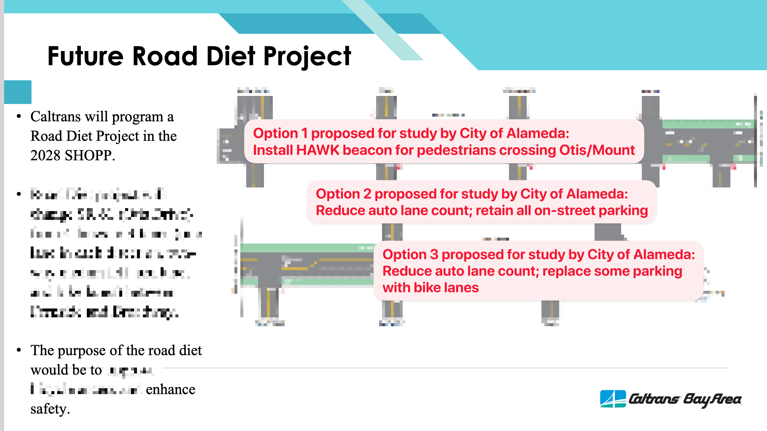
At last week's meeting, city staff spoke of three possible options that they want Caltrans to have considered in the 2028 road-diet plans:
- small option: Installing a HAWK beacon that would flash red lights when pedestrians press "beg" buttons to cross at Mound/Otis
- medium option: Reducing the number of straightaway auto lanes, to decrease speeding and decrease the distance for pedestrians and cyclists crossing Otis Drive
- large option: Reduce the number of straightaway auto lanes and add bike lanes for safely cycling along Otis Drive
Note that previously Caltrans staff only proposed the third "large" option, which is definitely worth studying, but only along with the context of the "small" and "medium" options — otherwise, the "large" option, if considered in isolation, could become a poison pill.
PIDs as time capsules
This second phase of a road diet won't be constructed until ~2032. However, working backwards, the work will begin soon. Caltrans District 4 will need to ask the California Transportation Commission to "program" this into the 2028 SHOPP cycle. To do that will involve first drafting a "project initiation document" (PID) over the next couple years.
The PID for the current project is its own time capsule of sorts. Caltrans D4 staff argue that the document from ~2018 predates their department's "complete streets" policies, letting them off the hook for having their district director sign forms attesting to their thoroughness to consider safety for pedestrians and cyclists. (Whether this is true is unclear; Caltrans seems to set its own rules.) Calling it a time capsule is generous — the PID for the current project is perhaps more like a zombie — outdated, opaque, and still inexplicably steering decisions in 2025.
Hopefully the PID to be drafted for 2028 will represent the start of a better process involving both Caltrans D4 and the City of Alameda — and a process that systematically pursues traffic safety for all users of Otis Drive. As I spoke to at last week's Transportation Commission meeting, this has been an awfully inefficient process, wasting so much staff time along the way. The public deserves better results on the ground and a more efficient use of finite resources to reach those results. City of Alameda staff have demonstrated they're more than ready to be involved, and I believe the Transportation Commission has shown it can be an effective venue for a "Goldilocks" amount of public airing and community input. It's up to Caltrans to accept these offers to work together more collaboratively, more efficiently, and more effectively toward a better Otis Drive.
Real people, real stakes
I began by mentioning my kindergartner's time capsule because time is what’s shaping Otis Drive: decades of inaction and also years of slow-moving action, stretched thin by bureaucratic processes that ping-pong from agency to agency, office to office. I also mentioned that time capsule because, as it happens, my son’s talented kindergarten teacher lives on this very stretch of Otis Drive.
The report listing precisely the number of seconds of motorist delay that Caltrans values more than traffic safety on Otis Drive is about a 296-page technical report by a consultant to Caltrans — a report that, whether it admits it or not, is also about daily life for real people. When Caltrans says it’s impossible to slow down shoppers driving to South Shore Center by even a few seconds, what their agency is saying is that it’s impossible to make life calmer and safer for the real people who live right there.
But a safe street isn’t impossible — it just takes clear enough eyes to lift the gauze of the status quo and see the risks we've normalized.
In 1973, Assemblymember Robert Crown was killed in a “double threat” auto-on-pedestrian crash along this very street, a crash that underscores the danger of four lanes of fast-moving traffic beside Krusi Park. With sustained focus from Alameda city staff — and, one hopes, a more collaborative Caltrans — we're now on track to finally address this hazard by the 60th anniversary of Crown's death in 2033.